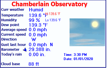
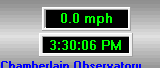
| Chamberlain Observatory | |||
|---|---|---|---|
| LAST READING AT TIME: 3:30 PM DATE: January 01 2020, time of next update: 4:00 PM | |||
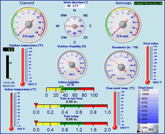
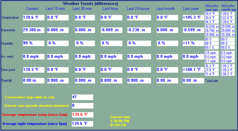
| Current Weather | Humid | Current Temperature | 139.6°F (59.8°C) (Heat Index 629.1°F ), Apparent temp 209.5°F |
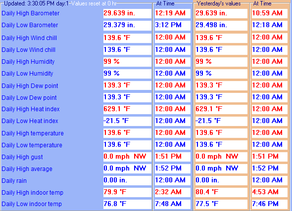
| Maximum Temperature (since midnight) | 139.6°F at: 12:00 AM | Minimum Temperature (since midnight) | 139.6°F at: 12:00 AM |
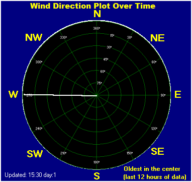
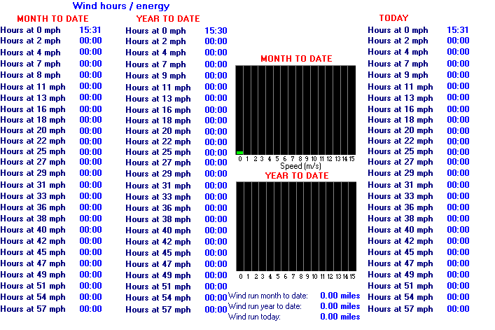
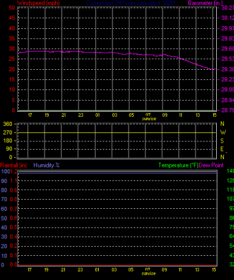
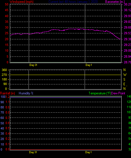
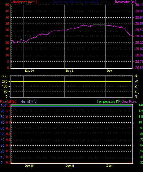
| Average windspeed (ten minute) | 0.0 mph | Wind Direction (ten minute) | W (270°) |
| Heat Index | 629.1°F | Maximum Gust (last hour) | 0.0 mph at: 3:00 PM |
| Maximum Gust (since midnight) | 0.0 mph at: 1:51 PM | Maximum 1 minute average (since midnight) | 0.0 mph at: 1:52 PM |
| Rainfall (last hour) | 0.00 in. (0.0 mm) | Rainfall (since midnight) | 0.00 in. (0.0 mm) --- |
| Rainfall This month | 0.00 in. (0.0 mm) | Rainfall To date this year | 0.00 in. (0.0 mm) |
| Maximum rain per minute (last hour) | 0.00 in/min | Maximum rain per hour (last 6 hours) | 0.00 in/hour |
| Yesterdays rainfall | 0.00 in | DewPoint | 139.3°F (Wet Bulb :139.3°F ) |
| Humidity | 99 %, Humidex 342.7°F | Barometer corrected to msl | 29.388 in. (995.2 hPa) |
| Pressure change | -0.01 in. (last hour) | Trend (last hour) | STEADY |
| Pressure change (last 12 hours) | -0.23 in | Pressure change (last 6 hours) | -0.20 in |
| Current Indoor Temp. 79.0°F | |||
| Current Indoor Hum. 32% | |||